


Making sense of the maps for your patch
By Alex Briggs - 16 May 2023
Weald to Waves is a citizen-led project powered by the individuals and groups pledging to take part. As project coordinators, we think a key part of our role is to provide the tools and resources the network needs to support nature recovery along the corridor. Among these tools are the interactive maps on our new website. They include a wide range of datasets designed to help you explore the project, the pressures and opportunities for wildlife in your area, and to identify how you can get involved in nature recovery. We’ve included some examples below to show some of the different ways to use and apply these maps.
Gardening for pollinators
Creating habitats for wildlife is a vitally important part of joining the dots for nature. We can all get involved in making a home for wildlife, no matter the scale, from a field or a greenspace to a flowerpot. Whether you are an individual with a garden, a land manager, or a community group there are many options for creating wildlife habitats to best suit you.
Our Opportunities Map includes a range of datasets that can help with habitat creation activities. Even if you have a small space, there are lots of things you can do, such as planting food sources for pollinators to bring bees and butterflies into your garden. Buglife International’s ‘**B-lines’ layer **(fig. 1) in our Opportunities Map shows the best connectivity between wildflower habitats remaining for declining pollinator species along and between sections of the corridor. Reconnecting our landscapes can be done with wildflower areas and window boxes, and makes a huge difference in reversing the decline of our pollinators.
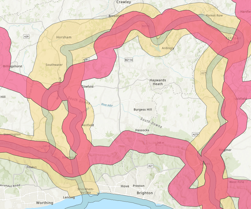 Fig 1: Buglife International’s B-lines layer: showing best connectivity routes between wildflower habitats for pollinators
Creating and restoring habitats
Try exploring the UK’s ‘Priority Habitat Inventory’ (fig 2) from Natural England, some of our most important habitats for biodiversity. This layer highlights the areas particularly important for nature, and the areas where we need to work together to join the dots and reconnect habitats. It is important to note that these maps do not replace the need for local assessment but are a useful tool for highlighting the need for habitat creation. Clicking the features around the map will bring up a description to help you find out more.
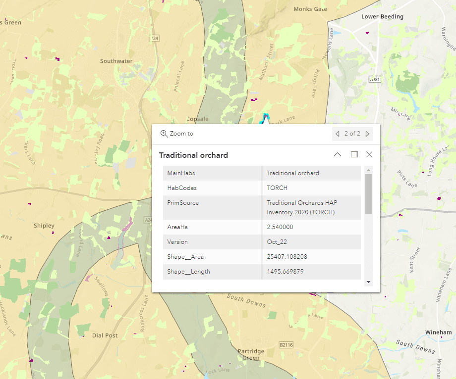 Fig 2: Natural England’s Priority Habitat Inventory layer: showing some of our most important habitats for biodiversity
Similarly, the ‘Habitat Networks’ layers (fig. 3) highlight areas of suggested activities for nature recovery around Priority Habitats, from habitat creation to expand and connect core areas, to encouraging sustainable management to make the landscape more permeable for wildlife.
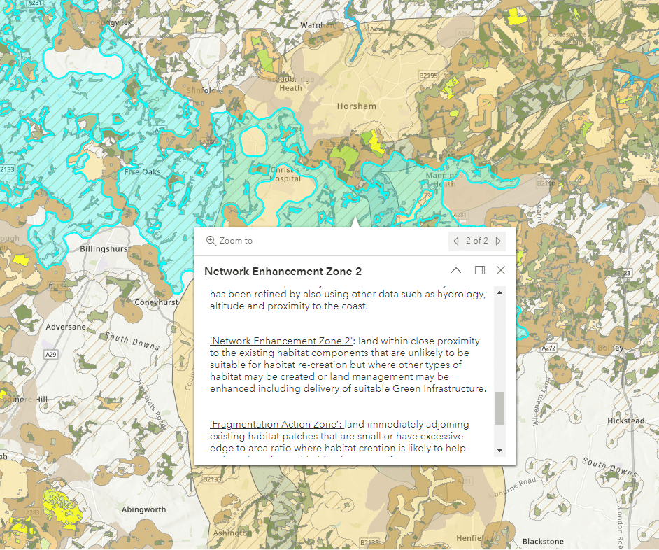 Fig 3: Natural England’s Habitat Networks layer offering suggested activities around Priority Habitats
Tree planting is a particularly important part of nature recovery, creating habitats and bringing a whole range of ecosystem services benefits. For example, planting trees around waterbodies can provide shade, and improve the resilience of freshwater ecosystems under pressure from climate change. The Riparian Shade layer(fig. 4), part of the Keeping Rivers Cool project from the Environment Agency, shows how well our rivers and streams are shaded, and highlights areas where more shade may be needed. This map doesn’t replace a local assessment to check that tree planting is suitable for each site, and do remember to seek landowner permission before planting trees.
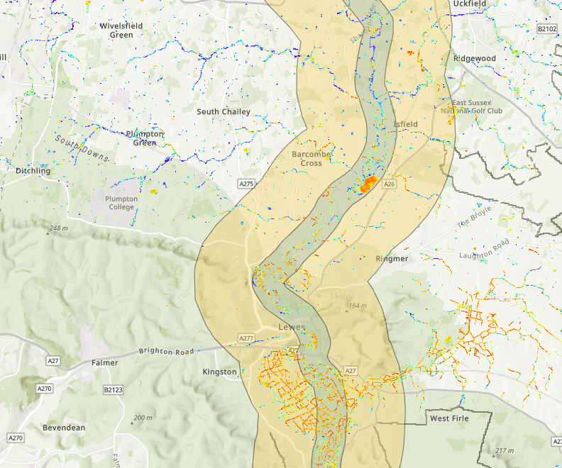 Fig. 4: Environment Agency’s Keeping Rivers Cool / Riparian Shade layer showing opportunities for tree planting along rivers
Working together for nature recovery
Weald to Waves is a partnership started by people who wanted to join forces to stop biodiversity decline in Sussex. Pledging to take part in the corridor means that you are joining a community of individuals, groups and organisations working together for nature recovery.
Our maps allow you to explore some of the groups and projects along the corridor to offer other ways of getting involved – if you don’t have outdoor space, why not join a group or organisation that is already involved in your area. As more and more community networks, charities, groups and organisations pledge to take part in Weald to Waves, they will appear in our interactive maps. You will be able to use these maps to explore the community groups in your area and find a way that suits you to get involved. By working together our impact will be greater.
Exploring the corridor
Perhaps one of the best ways to engage with the corridor is to get out and about and experience the wildlife and habitats we want to protect and restore. Unlike a nature reserve, Weald to Waves has no visible borders. Instead the corridor runs across the Sussex landscape and includes a huge variety of interesting sites and features to explore.
Our ‘Opportunities’ map includes layers showing the public rights of way, greenspaces, parks and open-access land (fig. 5) available to explore in your area, along with the Sustrans bicycle network and national trails like the South Downs Way and England Coast path that follow parts of the corridor.
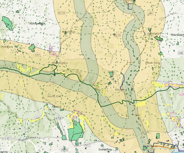 Fig. 5: Opportunities map, showing public rights of way, greenspaces, parks and open-access land
If you want to go for a walk to explore the corridor, our ‘Walk the Corridor’ map (fig. 6) has been created with the kind permission of AllTrails, to show you suggested routes around the corridor. We have collected together some of the best routes, ranked and reviewed by other users, and included walks of a range of difficulties, lengths, features of interest and accessibilities to ensure there is something for everyone. Remember to let us know what you find along the way!
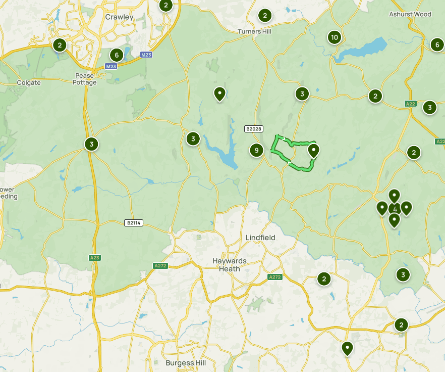 Fig. 6: AllTrails’ ‘Walk the Corridor’ map
Explore our interactive maps to find something you could do to help nature in your garden or greenspace. If you have any questions or feedback about the interactive maps, please email info@wealdtowaves.co.uk